Delta Consumptive Water Use Comparative Study
Catagories: Agriculture Economics | Systems Analysis in Water
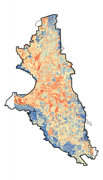
A better overall understanding of consumptive use (CU) in the Delta is critical not only to water rights administration, but also to water project management, agricultural irrigation management, and to environmental and water quality protection. The purpose of this project is to develop a better understanding of CU in the Delta, to coordinate efforts and information derived from independent research efforts, and to consolidate information about methods for measuring CU within the Delta. The Center for Watershed Sciences will gather, analyze, and disseminate data about actual direct evaporation and plant transpiration in the Delta (sometimes referred to as evapotranspiration, or ET) and organize and use the ET data to facilitate comparative tests of up to seven selected methods for measuring CU:
- California Simulation of Evapotranspiration of Applied Water, “CalSIMETAW” (California Department of Water Resources – DWR),
- Delta Evapotranspiration of Applied Water, “DETAW” (DWR),
- Disaggregate Atmosphere-Land Exchange Inverse, “DisAlexi” (United States Department of Agriculture – Agricultural Research Service – ARS),
- Mapping EvapoTranspiration at high Resolution with Internalized Calibration, “METRIC” (California Polytechnic Institute, San Luis Obispo – Irrigation Training and Research Center – ITRC),
- METRIC (University of California, Davis – UC Davis),
- Satellite Irrigation Management Support system, “SIMS” (National Aeronautics and Space Administration – Ames Research Center- NASA), and
- Priestley-Taylor (UC Davis).
In addition, CWS will access existing and emerging data developed under other ongoing research efforts to augment and inform the CU investigation. The CWS will coordinate with independent researchers so as to benefit from their parallel efforts to provide more comprehensive understanding of CU in the Delta.
Additionally, a study to compare Actual Evapotranspiration (ET) estimates between Landsat 8 coarse resolution (30 meters-pixel) and unmanned aerial vehicle (UAV) fine resolution (1.0 meter-pixel) was carried out in crops of alfalfa, pasture and maize. Findings showed that ET mapping at high resolution delivers relevant data that is not possible to detect at Landsat 8 scale. UAV showed higher level of ET spatial variability (up to 75.3 and 45.4% for Max-Min values respectively), which in practical terms represents valuable information to detect areas of crop stress, salinity, differential infiltration, responses to water management at field scale, problems with lack of uniformity in water and fertilizer applications, among others.
Principal Investigators: Josué Medellín-Azuara, Kyaw Tha Paw U, Yufang Jin, and Jay R. Lund
Report Preparation and Research Assistance: Jesse Jankowski, Eric Kent, Jenae’ Clay, Andy Wong, Andrew Bell, Nicholas Santos, and Jessica Badillo, University of California, Davis
Other Collaborators and Research Support From: Michael George, Delta Watermaster, California State Water Resources Control Board, Commissioned by the Office of the Delta Watermaster
Field Campaign Group: Kyaw Tha Paw U, Eric Kent, Jenae’ Clay, Michelle Leinfelder-Miles, Jean-Jacques Lambert, Megan McAuliffe, David Edgar, Sean Freiberg, Ruolan Gong, Megan Metz, Cayle Little, Bekele Temegsen
CalSIMETAW: Morteza Orang, Richard L. Snyder, Quinn Hart, Sara Sarreshteh, and Simon Eching
DETAW: Tariq Kadir and Lan Liang
DisALEXI: Martha Anderson
ITRC: Daniel Howes
SIMS: Forest Melton, Alberto Guzmán, Lee Johnson, Carolyn Rosevelt, and Kirk Post
UCD-METRIC: Nadya Alexander, Nicholas Santos, Andrew Bell, Justin Merz and Quinn Hart
UCD-PT: Yufang Jin, Andy Wong
Unmanned Aerial Vehicles: J. Andrés Morandé, Ricardo Trezza, Andreas Anderson, Kyaw Tha Paw U, Yufang Jin, Josué Medellín-Azuara, Jesse Jankowski, Jessica Badillo, Joshua H. Viers, YangQuan Chen
WRF-ACASA: Kyaw Tha Paw U, Eric Kent, Jenae’ Clay, Rex David Pyles
Peer Review Panel:
Richard Allen, Byron Clark, Richard L. Snyder and Thomas Trout
- Main Report
- Appendix Set: (Link to Box folder)
- Appendix A: Comparative Study Methodology and Additional Data
- Appendix B: Field Campaign Report for Water Years 2015-2016 and 2016-2017
- Appendix C: California Simulation of Evapotranspiration of Applied Water (CALSIMETAW)
- Appendix D: Delta Evapotranspiration of Applied Water (DETAW): A Layperson’s Guide to DETAW.
- Appendix E: Atmosphere-Land Exchange Inverse Flux Disaggregation Approach (DisALEXI)
- Appendix F: Irrigation Training and Research Center Mapping Evapotranspiration at High Resolution with Internalized Calibration (ITRC-METRIC)
- Appendix G: NASA Satellite Irrigation Management Support (SIMS)
- Appendix H: Mapping Evapotranspiration at High Resolution with Internalized Calibration, University of California Davis, Approach (UCD-METRIC)
- Appendix I: Priestley-Taylor UC Davis Approach (UCD-PT)
- Appendix J: Land Use Mapping of the Sacramento-San Joaquin Delta by Land IQ, Inc.
- Appendix K: Additional Evapotranspiration Estimates and Figures
- Appendix L: Evapotranspiration Estimation from Unmanned Aerial Vehicle Imagery
- Appendix M: Regional-Scale Weather Modeling with WRF-ACASA
- Model Data, Spreadsheets, Field Data, Land Use, and GIS files
Medellín-Azuara, J., Paw U, K.T., Jin, Y., Jankowski, J., Bell, A.M., Kent, E., Clay, J., Wong, A., Alexander, N., Santos, N., Badillo, J., Hart, Q., Leinfelder-Miles, M., Merz, J., Lund, J.R., Anderson, A., Anderson, M., Chen, Y., Edgar, D., Eching, S., Freiberg, S., Gong, R., Guzmán, A., Howes, D., Johnson, L., Kadir, T., Lambert, J.J., Liang, L., Little, C., Melton, F., Metz, M., Morandé, J.A., Orang, M., Pyles, R.D., Post, K., Rosevelt, C., Sarreshteh, S., Snyder, R.L., Trezza, R., Temegsen, B., Viers, J.H. (2018). A Comparative Study for Estimating Crop Evapotranspiration in the Sacramento-San Joaquin Delta. Center for Watershed Sciences, University of California Davis.
